I, that is Chris, arrived back from Switzerland on the morning of the 25th December, and we immediately began planning for our hiking trip to the Bale Mountains National Park which we had booked to do over the New Year. We would be camping for four nights.
But first a word of warning. Before we left I fully charged my camera battery. Unfortunately, I forgot to turn my camera off and by the time we arrived in the mountains, the battery was flat! And no electricity, so no chance to recharge. So photos are confined to those taken with Ursula’s cell phone and a small pocket camera I had. Both ok for scenic but not much good for wildlife unless they are very close.
The security situation means that there are a lot of road blocks and searches if you travel by road, so we decided to fly down, but send our packs by road with the tour company.
A bit of background. Bale Mountain National Park has an area of 850 square miles (2201 sq.km) and lies at an elevation of between 3000 and 4300 metres (10,000 – 14,000ft) and has an Afro-Montane or Afro-Alpine ecology. Most of the time we were there we were between 12,000 and 14,000 ft. The mountains were formed from volcanic eruptions hundreds of millions of years ago. The park is about 400km from Addis by road.
29th December
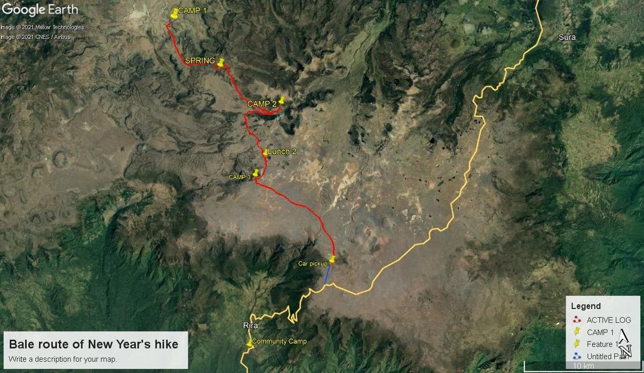
1. Map of the route we took
We flew to Robe airport where we were met by the tour driver, Abel, and our guide for the hike, Muzeyen. We drove to the park entrance at Dinsho, but first drove around the lowlands of the park, grass and woodland, and the area where most of the antelopes are found. From the car we saw many Nyala, Bushbuck, warthog and other lowland mammals.

2. A small group of Nyala by the roadside, close enough to attempt a photo
We checked in with the park authorities at the gate at Dinsho and drove to where we were to spend our first night at Camp 1 on the map. This gave us our first view of the Bale landscape.
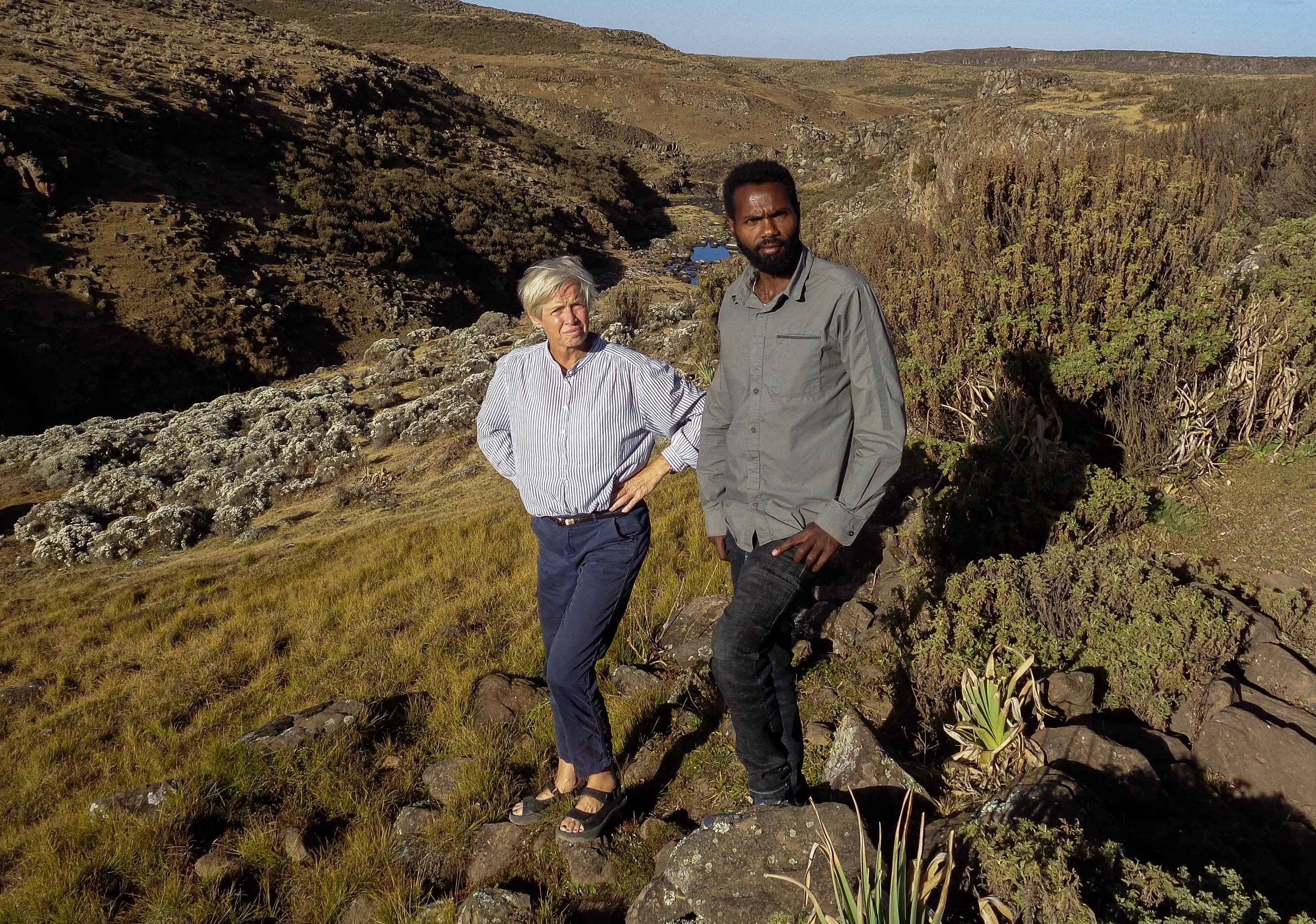
3. Ursula and our guide Muzeyen
This was at the base established by the Ethiopian Wolf Conservation Project (EWCP) as part of their project. The stone building is used by the project for their staff, and we were able to use it as a dining room and the use the deck. It had a small wood oven and the room was warm!. The height at this camp was 3520 metres (11,520 ft) and so was not as cold as it would be on subsequent days, but it was cold nonetheless.
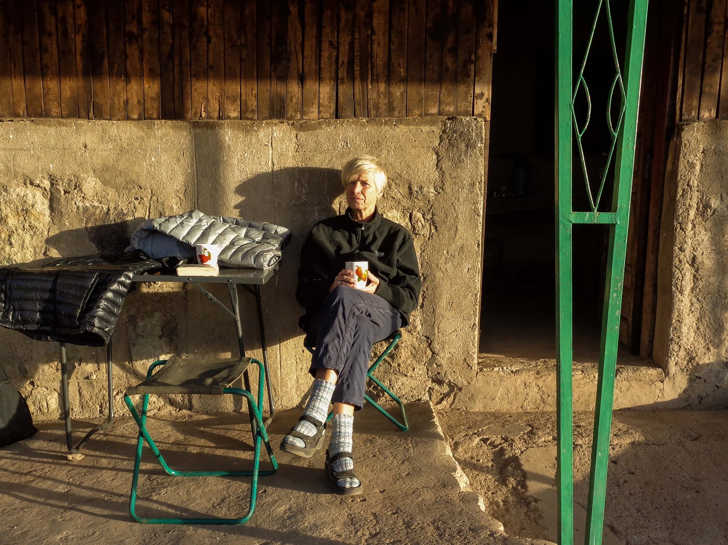
4. On the deck at the EWCP hut
Note on the Ethiopian Wolf.
There are only approximately 500 Ethiopian Wolves surviving in the wild, of which about 250 are found in the Bale Mountains. We were lucky enough to see 10 individuals, or about 4% of the Bale population
The Ethiopian Wolf is found only in Ethiopia, and is descended from the European Grey Wolf which spread to Africa during glacial periods. During this period the Ethiopian Wolf diverged from the Grey Wolf ancestor. When the glaciers retreated at the end of the ice age, about 15000 years ago, the Afroalpine habitat fragmented and is now only found in the highlands above 3000 metres. This left populations of the Ethiopian wolf isolated from each other, and are now only found in the Bale Mountains, the Simien Mountains, the Wollo Highlands, Guassa Menz and Arsi. It has gone extinct in another three areas. It is threatened by habitat loss and by contracting diseases from domestic dogs such as rabies and distemper, as well as by interbreeding with domestic dogs.

5. Inspecting our tent.
We spent our first night in the two-person (just) tent, wrapped inside sleeping bags and almost fully clothed.

6. Looking down on the ERWCP camp. The corral with our 3 horses are on the right in the picture.
30th December
In the morning, we started on the first proper day of our hike. We left the Landcruiser behind and all our luggage, which was loaded onto the horses to be taken to the next camp. The walk was 16 km long and we climb to a height of 3950 metres (12940 ft). This change from the campsite might not seem much, a little more than 400 metres, but the altitude left me, in particular, gasping for breath on some of the steeper hills. After 3 weeks in Bern, I had not even acclimatised to Addis, never mind the mountains.

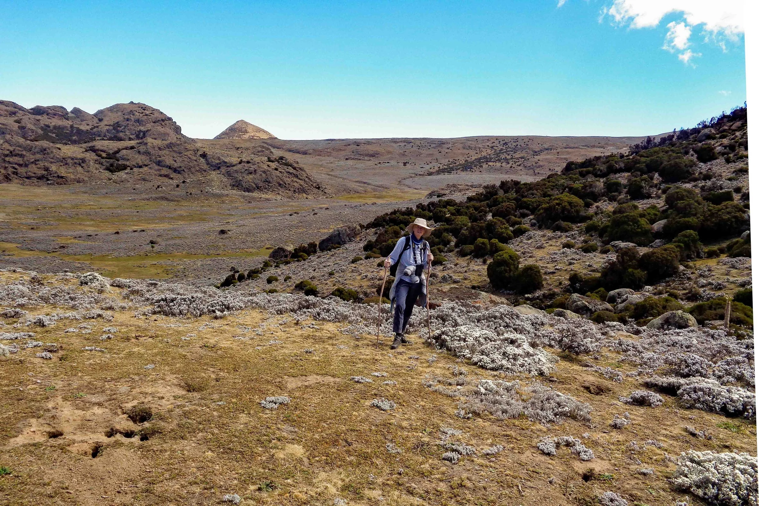
7. Fairly typical landscape for the first day’s hike. The Bale mountains are volcanic, cut by erosion into some steep cliffs and rolling hills.
This is the dry season and the grass was dry and brown, except where there was some water seepage giving green patches. There were springs along the way and we stopped at one for our packed lunch.

8. Lunch at a spring-fed pool, but not drinkable - Chris found a cows head rotting away a little upstream from where we were sitting.
A chance to take boots off and cool feet in the cold water. Although this is a national park, a large number of people live in the park. At this time of year most of these people have moved to the lowlands and are harvesting their crops. Later in the year they will come back up with their livestock. A bit like the dairy farming in Switzerland. However, we did see this couple riding past.
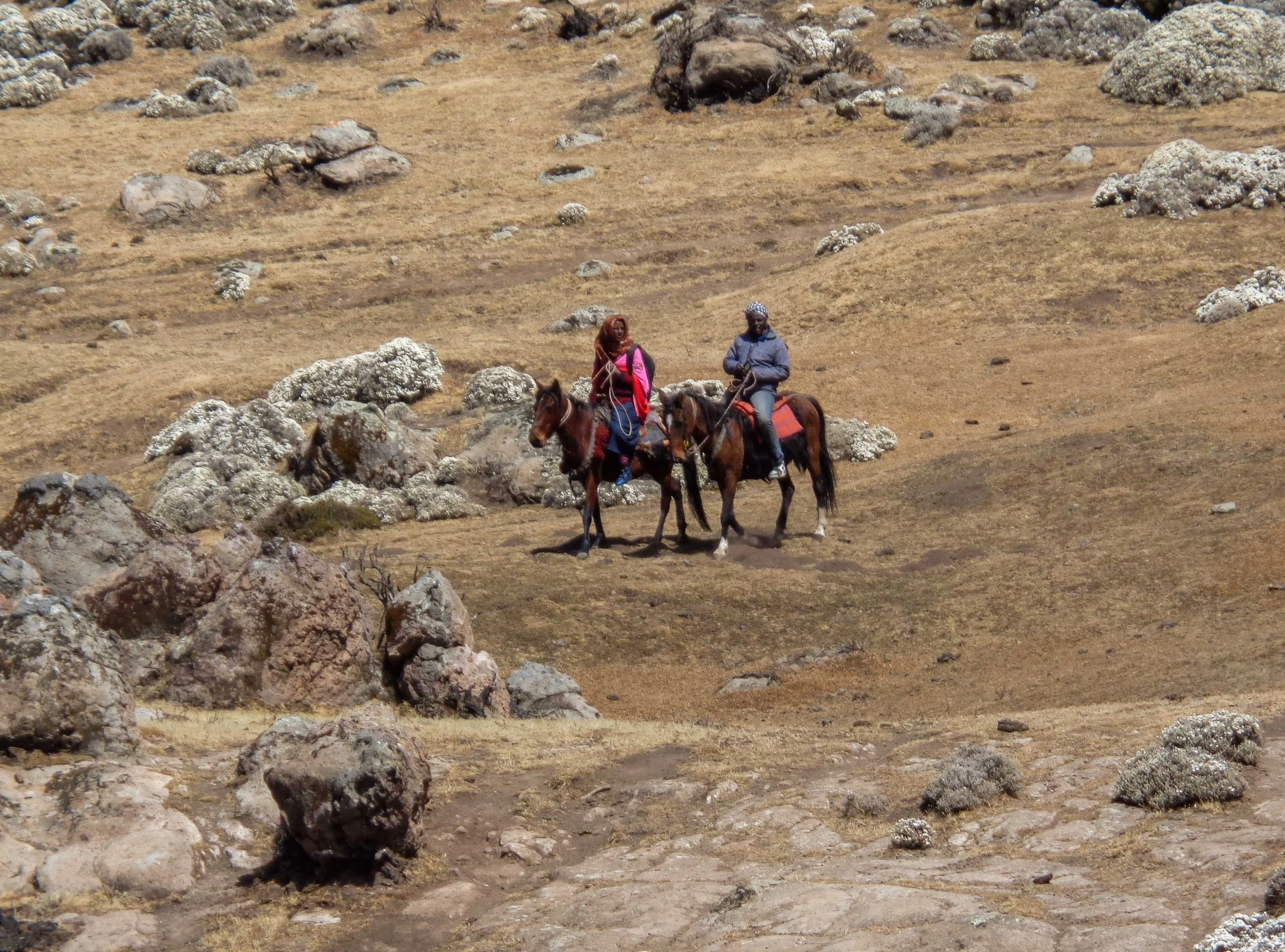
9. Going who knows where.
We passed several huts abandoned for the winter. These are of a “wattle and daub” construction, the daub being a mixture of cattle dung and mud and are known as tukuls. In the summer, wet season, the owners will return with their livestock.

10. A homestead tukul looking a bit Marie Celeste, shoes and other utensils just abandoned for the winter.
With cloudless skies the temperature climbs rapidly during the day, but drops equally fast at night. For most of our time we were above the tree line. It is mostly a moorland habitat and the vegetation is almost entirely grass and low scrub.

11. A lonesome “tree” or tall shrub on the rocky plateau.
After about 7 hours and a little over 16 km walking, we arrived at our second night’s camp site, Camp 2 on the map. The cooks and the horses had got there before us and welcome flasks of tea and coffee were awaiting us. The camp was at an altitude of 3940 metres. I think it is worth pointing out that this is 200 metres (650 feet) higher than Mt. Cook in New Zealand, 12,316 feet (3,754 metres)

12. Camp 2 with the 3 tents and the “kitchen” against the large rock.

13. The horse handlers were already warming themselves when we arrived at the camp.
After a hot, 3-course meal, prepared by the cook and his assistant, we sat round the fire warming ourselves before climbing into our sleeping bags. The two of us found that we ate much more than we usually do, presumably a function of the altitude and exercise, and the cold.

14. Gathered round the fire, the two in red are the horsemen, the man in blue against the rock is the assistant cook, the cook with his arms folded and our guide on the left of the picture, wearing a cap.
We found the best way to survive was to go to bed fully dressed, with 2 pairs of socks and blankets over the sleeping bags. The ground was hard through the thin mattresses, and frost formed on the flysheets of our tents. But in spite of this we slept well, going to our bags between 7 and 7.30 in the evening and getting up at 6.30 the next morning. The natural life, down with the sun in the evening, and up with the sun in the morning
31st December
Up at dawn we huddled round the morning fire waiting for a cup of coffee before breakfast of pancakes and fresh fruit, more coffee, and tea. We set off on the next leg, leaving the cook and his assistant to break camp and load the horses. Later that day we met up with them as their, shorter, path crossed our more scenic route.

15. Our caravan on its way to our third campsite.
At these altitudes you dehydrate rapidly and you have drink water continuously, even though you barely break a sweat. By this time, I was beginning to feel dizzy spells and headaches. The only solution to these symptoms is to drink even more water and take frequent rests.

16. Resting up at lunch break
Bale Mountain Park is mostly a plateau formed by volcanic eruptions 20 to 30 million years ago. As a result, the topography is gently undulating with only a few steeper inclines on the slopes of surviving volcanic cones, none still active. In spite of this mostly gentle landscape we frequently found ourselves out of breath.
17. Sticks are useful, even on the gentle slopes.
The wind was cold across the plateau and for a while the clouds came down, and we were relieved finally to reach our camp at Rafu, Camp 3. A seasonally abandoned tukul had been commandeered as the kitchen, and by the time we arrived the cook had flasks of hot tea and coffee waiting for us. We huddled in the lee of the tukul sheltering from intermittent light hail and gradually warmed up.
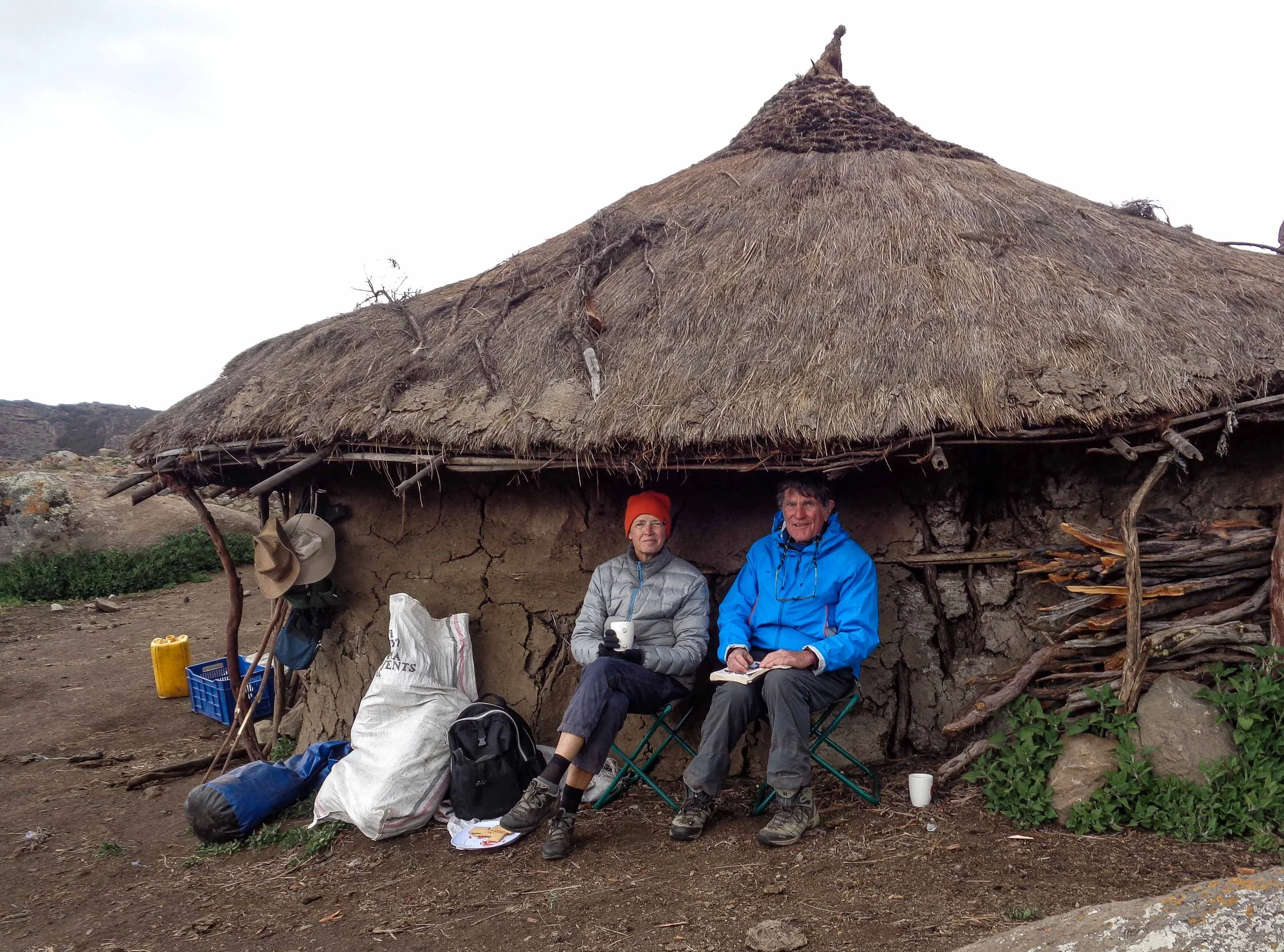
18. Sheltering in the lee of the tukul, hot drinks to hand
Rafu has a magnificent view down a valley and our guide considers it to be one of the most spectacularly beautiful areas of the park. The altitude is 4020 metres (13200 feet), although we had been higher during the day.

19. The view from the campsite down the valley, shortly after dawn. In the shade the ground is still white with frost.
In the late afternoon our guide took Ursula on a walk to the Rafu Rock Pinnacles, an extraordinary rock formation of massive vertical blocks of lava, fractured and cracked by ice and water. I still had headaches and was feeling too dizzy to join them.

20. The Rafu rock pinnacles, 1
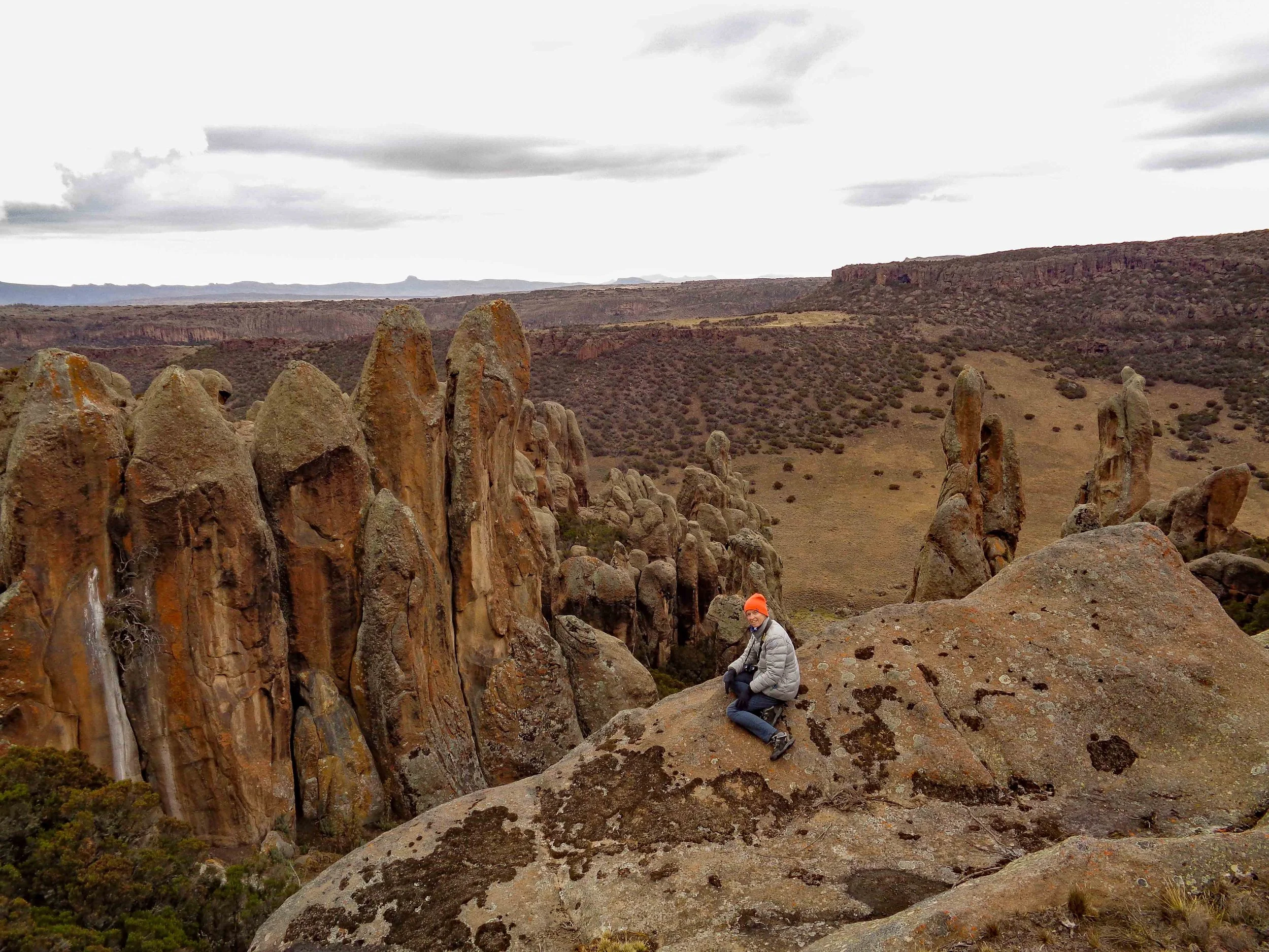
21. The Rafu rock pinnacles, 2
We brought in the New Year, a little early, about 7.30pm, with a small glass of local gin, no tonic, and an acceptable bottle of red wine. This kept us up until about 8 pm, so we failed, again, to reach midnight.
1st January 2022
The night was probably the coldest of the trip, and in the morning the zip flysheet on our tent was frozen. We managed to open one end, but the other end remained firmly jammed solid until the sun reached us and melted the frost. Even in these conditions the cook managed another wonderful breakfast, with plenty of tea and coffee.

22. Smoke billowing from the kitchen tukul early in the morning
After taking the above photograph, I (Chris) tripped over a root and fell badly bruising the front of my thigh. This made walking difficult and painful for the next few days, but fortunately we were crossing the Sanetti plateau, one of the flattest areas of the park. Nevertheless, it is rough and stony, making walking fraught.

23. Crossing the Sanetti plateau
With Chris limping slowly along, we finally made it to our car, where we were to separate from our horse “caravan” and their handlers. One last group photograph and we separated, they to return the horses and equipment to their homes.

24. The full caravan, horses included. We owe a debt of thanks to all the members of our group for making the trip such a wonderful experience.
After making our farewell, the rest of the team, cooks and our guide, were driven downhill to our overnight stay at a community lodge on the outskirts of the village of Rira. Basic but very welcome. To sleep on a mattress that night was such a joy, to be able to spread out under the duvet and be satisfyingly warm seemed to be a real luxury.
The lodge lies on the edge of the Harenna forest and the next morning Ursula went for a short walk with the guide to a waterfall, but my leg was still too painful to join them. Harenna forest is a cloud forest, and the trees are covered in mosses and lichens. It is also notable because of the wild coffee trees growing in the region, and these are still harvested by the people of Rira. There are also reputed to be a few surviving lions in the forest, but they keep well out of the way of humans.
Finally, it was time to leave. The Landcruiser was loaded.

25. Loading up
The last photos taken

26. The owner of the camp is tall man on the left.
27. The end of a wonderful trip.
And we left for the drive back to the airport. On the way we recrossed the edge of the Sanetti Plateau, where we saw several species of eagle and had our last sighting of the Ethiopian Wolves.
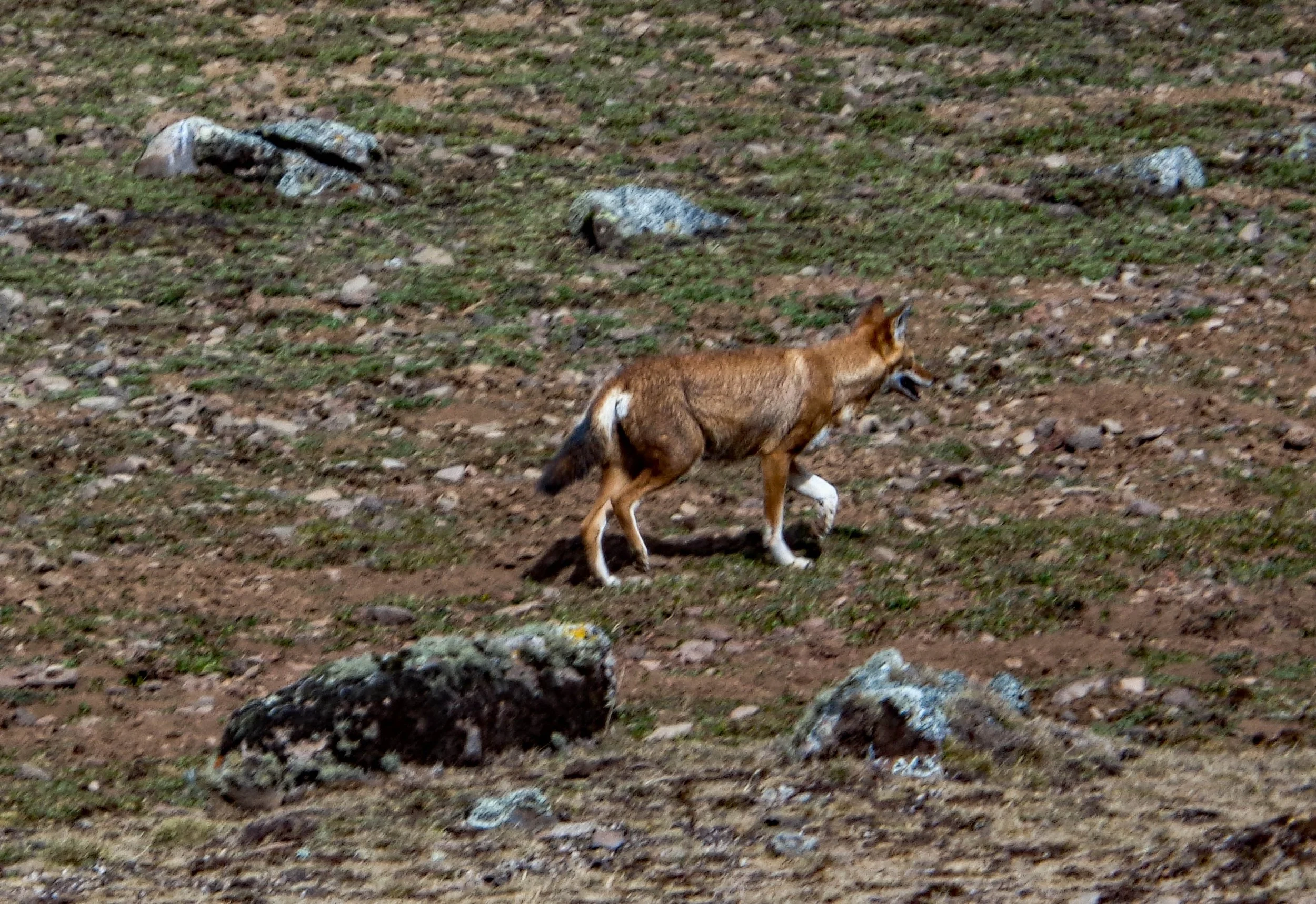
28. The Ethiopian wolf. Stands about knee high and has a long thin snout for capturing its prey, the mole rats and other rodents that live in burrows.

29. A female scent marking on the edge of her territory
Notes on the Ethiopian Wolf for the interested
There are only approximately 500 Ethiopian Wolves surviving in the wild, of which about 250 are found in the Bale Mountains. We were lucky enough to see 10 individuals, or about 4% of the Bale population
The Ethiopian Wolf is found only in Ethiopia, and is descended from the European Grey Wolf which spread to Africa during glacial periods. During this period the Ethiopian Wolf diverged from the Grey Wolf ancestor. When the glaciers retreated at the end of the ice age, about 15000 years ago, the Afroalpine habitat fragmented and is now only found in the highlands above 3000 metres. This left populations of the Ethiopian wolf isolated from each other, and are now only found in the Bale Mountains, the Simien Mountains, the Wollo Highlands, Guassa Menz and Arsi. It has gone extinct in another three areas. It is threatened by habitat loss and by contracting diseases from domestic dogs such as rabies and distemper, as well as by interbreeding with domestic dogs.